Panuto: Sundan ang mga panuto na nakasulat sa ibaba para magawa ang gawain. Kung sakaling magkaroon ng kahirapan, bumalik sa homepage para hindi ka mawala.
Sasagutan sa #12 pagkatapos makita ang mga sumusunod na anyong lupa at tubig sa Asia ang magsisilbing Gawain 2 o 3. Isulat ang inyong kasagutan sa inyong Activity notebook.
Anyong Lupa at Tubig sa ASIA:
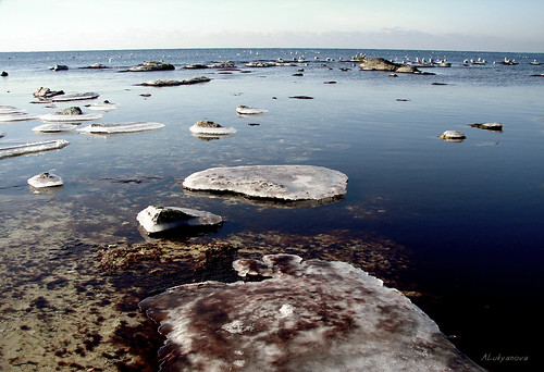
1. Baikal Lake
Lake Baikal is the deepest lake in the world,and the largest freshwater lake in the world by volume.[At more than 25 million years old, it is the oldest lake in the world.
Eclick ang site para makita ang larawan ng lawang Baikal
http://www.russianspy.org/wp-content/uploads/2006/12/baikal_lake.jpg
http://www.greenpeace.org/raw/image_full/russia/en/photosvideos/photos/map-of-baikal-lake-area.gif
http://unexpo.org/datas/content/baikal_winter.jpg
https://blogger.googleusercontent.com/img/b/R29vZ2xl/AVvXsEgjRgUUeJ9N3EAg-zTyEpHw83I0aipvAS71E3slK1HeyJ0L3ilz4nHTjhsaqpSXxSEyuzRKp40aRFv_IqChknBuYmtmZ3Zg0TDE-oMcWcPy1Jp0TR4W4WUH6w0UD9kcQxiX7S4kmE1mUrWv/s320/baikal+lake.jpg
2. Caspian Sea
The Caspian Sea is the largest enclosed body of water on Earth by area, variously classed
as the world's largest lake or a full-fledged sea.
Eclick ang site para makita ang larawan ng dagat Caspian. (Gayon din sa mga susunod pa na mga anyong lupa at tubig)
http://en.wikipedia.org/wiki/File:Caspian_Sea_from_orbit.jpg
http://www.payvand.com/news/07/sep/Caspian-Sea-map_s.jpg
http://farm4.static.flickr.com/3249/3144677924_f014df8bbe.jpg
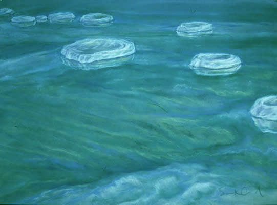
3. Dead Sea
The Dead Sea "Sea of Salt"; is a salt lake between Israel and the West Bank to the west, and Jordan to the east. It is 422 metres (1,385 ft) below sea level, and its shores are the lowest point on the surface of Earth on dry land. The Dead Sea is 378 m (1,240 ft) deep, the deepest hypersaline lake in the world. It is also one of the world's saltiest bodies of water, with 33.7% salinity.
http://en.wikipedia.org/wiki/File:Dead_Sea_by_David_Shankbone.jpg
http://www.ttu.edu.jo/ttu/Ar_Pages/picc/images/dead_sea_sunset.jpg
http://english.people.com.cn/200604/17/images/0416_A67.jpg
http://www.susanarnold.org/images/dead-sea.jpg
http://www.genesisfiles.com/Images/DeadSea2.jpg
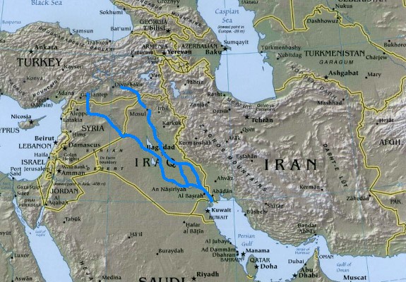
4. Tigris and Euphrates River
Historically, the area is known as Mesopotamia. As part of the larger Fertile
Crescent, it saw the earliest emergence of literate urban civilization in the Uruk
period, for which reason it is often dubbed the "Cradle of Civilization".
http://www.godandscience.org/images/edenmap.jpg
http://www.layittoheart.com/riversofcush.jpg
http://www.archatlas.dept.shef.ac.uk/EnvironmentalChange/Slide10.jpg
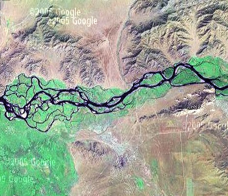
5. Yenesei River
Yenisei is the greatest river system flowing to the Arctic Ocean, and at
5,539 km (3,445 mi) is the fifth longest river in the world. Rising in Mongolia,
http://www.khoomei.com/geopics/xairakan.jpg
http://aquadoc.typepad.com/photos/uncategorized/2007/06/13/mississipi_river__new_orleans.jpg
http://www.sbras.nsc.ru/consult/pic/siberia5.jpg
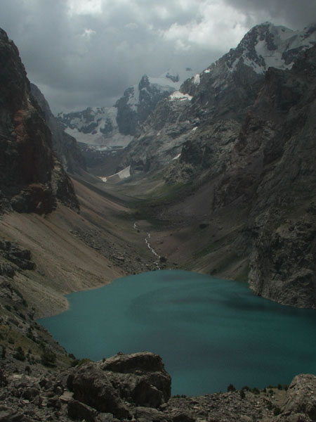
6. Pamir Mountains
The Pamir Mountains are a mountain range in Central Asia formed by the junction or knot of the Himalayas, Tian Shan, Karakoram, Kunlun, and Hindu Kush ranges. They are among the world’s highest mountains and since Victorian times they have been known as the "Roof of the World", translated from "Pamir".
http://asia.cnet.com/i/r/2005/dc/39254474/sc004.jpg
http://www.advantour.com/img/tajikistan/lake/lake_big_allo.jpg
http://www.geocities.com/xoroq/Tajikistan_Pamir_mountains2.jpg
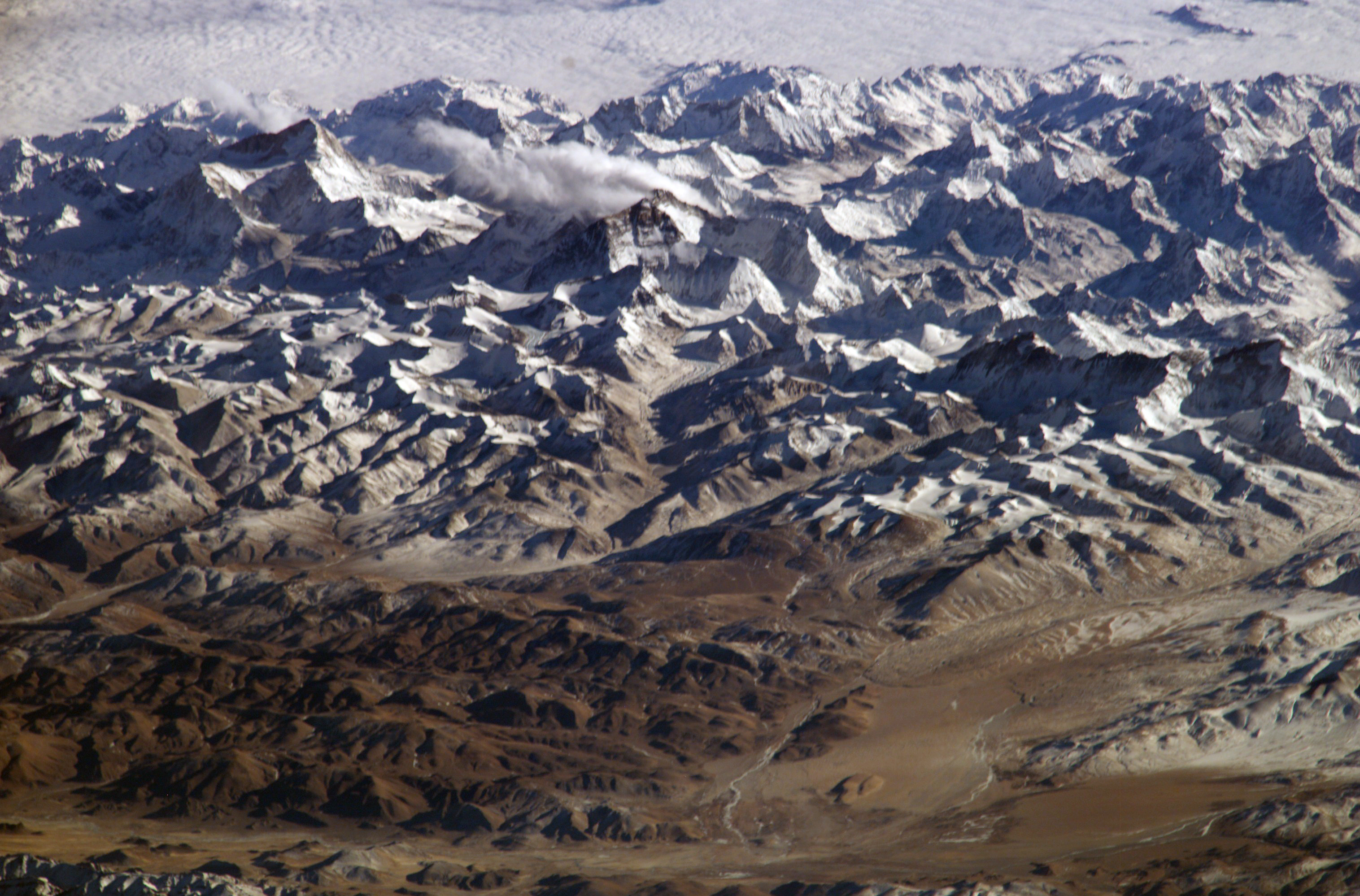
7. Himalayas
The Himalaya Range or Himalayas for short (English pronunciation, meaning "abode of snow", is a mountain range in Asia, separating the Indian subcontinent from the Tibetan Plateau. The Himalayan mountain system is the planet's highest and home to the world's highest
peaks.
http://www.destination360.com/asia/china/images/s/china-himalayas.jpg
http://www.mountainsmagnificent.com/himalayas.jpg
http://upload.wikimedia.org/wikipedia/commons/7/79/Himalayas.jpg
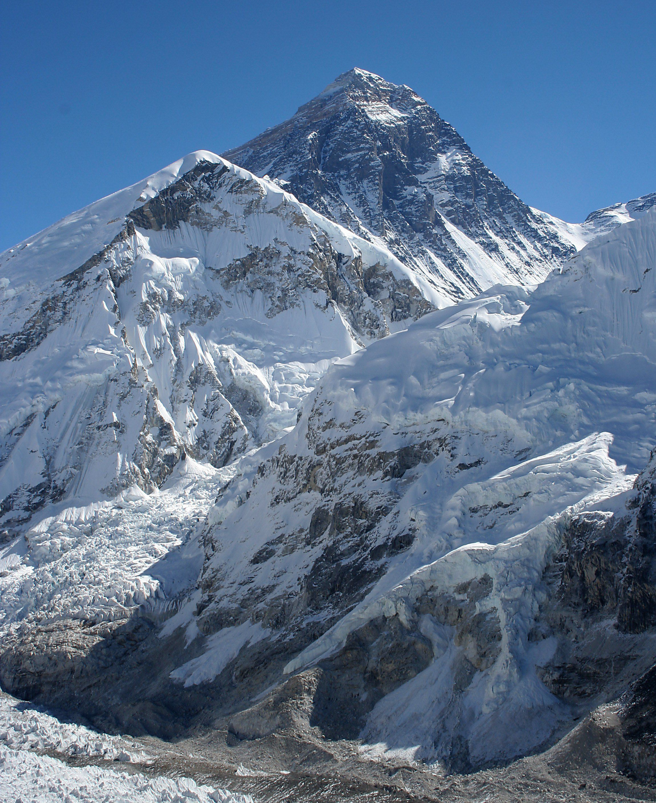
8. Mt. Everest
Mount Everest – – is the highest mountain on Earth, as measured by the height above sea level of its summit, 8,848 metres (29,029 ft). The mountain, which is part of the Himalaya range in High Asia, is located on the border between Sagarmatha Zone, Nepal, and Tibet, China
http://www.letsgodigital.org/images/artikelen/39/mount-everest.jpg
http://www.destination360.com/asia/china/images/s/china-mt-everest.jpg
http://upload.wikimedia.org/wikipedia/commons/4/4b/Everest_kalapatthar_crop.jpg
http://www.mtholyoke.edu/~shres20e/classweb/web_pictures/Mount_Everest.jpg
9. Tibet
Tibet isplateau region in Asia, north of the Himalayas, and the home to the indigenous Tibetan people and some other ethnic groups, such as Monpas and Lhobas. With an average elevation of 4,900 metres (16,000 ft), it is the highest region on Earth and has in recent decades increasingly been referred to as the "Roof of the World".
http://travellingboard.net/wp-content/uploads/2007/09/lake-in-tibet.jpg
http://www.chinatour.com/tibet.pictures/tibet.location.gif
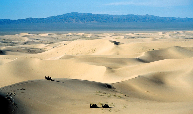
10. Gobi Desert
The Gobi is the largest desert region in Asia. It covers parts of northern and northwestern China, and of southern Mongolia. The desert basins of the Gobi are bounded by the Altai Mountains and the grasslands and steppes of Mongolia on the north, by the Hexi Corridor and Tibetan Plateau to the southwest, and by the North China Plain to the southeast. The Gobi is made up of several distinct ecological and geographic regions based on variations in climate and topography. This desert is the fifth largest in the world.
http://innovateca.files.wordpress.com/2008/05/gobi-desert.jpg
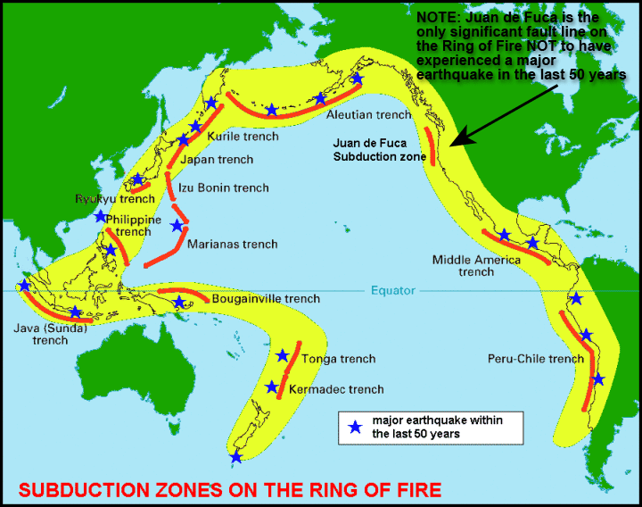
11. Pacific Ring of Fire
The Pacific Ring of Fire (or sometimes just Ring of Fire) is an area where large numbers of earthquakes and volcanic eruptions occur in the basin of the Pacific Ocean. In a 40,000 km horseshoe shape, it is associated with a nearly continuous series of oceanic trenches, volcanic arcs, and volcanic belts and/or plate movements. The Ring of Fire has 452 volcanoes and is home to over 75% of the world's active and dormant volcanoes. It is sometimes called the circum-Pacific belt or the circum-Pacific seismic belt.
http://www.rumormillnews.com/pix/pic62180.gif
http://standeyo.com/Reports/041222.EQ.warning/West.Coast/ring.of.fire.gif
http://library.thinkquest.org/TQ0312395/rof.gif
12. Rub-al-Khali Desert
The Rub' al Khali , which translates as Empty Quarter in English, is one of the largest sand deserts in the world, encompassing most of the southern third of the Arabian Peninsula, including southern Saudi Arabia, and areas of Oman, the United Arab Emirates and Yemen.
http://flann4.files.wordpress.com/2008/04/sand-dunes-rub-al-khali.jpg
http://maps.ihs.com/basin-monitor/middle-east/images/300318oil-and-gas-rub-al-khali-province.jpg
http://www.alovelyworld.com/webyemen/gimage/yem27.jpg
13. Base sa nakitang mga larawan ng mga anyong lupa at anyong tubig sa Asia lagyan ng diskripsyon ang mga sumusunod:
Activity 2 Date: June ___, 2009
Anyong Lupa at Tubig Diskripsyon/Bansag
1. Baikal lake -
2. Caspain Sea -
3. Dead Sea -
4. Tigris at Euphrates -
5. Yenesei River -
6. Himalayas -
7. Pamirs -
8. Mt. Everest-
9. Rub-al-Khali-
10. Tiobet -
11. Gobi -
12. Pacific Ring of Fire -
13. Magbigay ng dalawang mungkahi para mapanatili at maalagaan natin ang
napakagandang biyaya ng kalikasan sa mga mamamayang malapit dito.(aksyon na
pwedeng gawin)
Paalala: Siguraduhing naisaayos ang upuan at isarado ang site na binuksan para sa gawain.
SALAMAT!
No comments:
Post a Comment